
As-Built Documentation for Architects, Designers & Renovation Projects
High-accuracy 3D laser scanning and CAD documentation for existing buildings, renovations, tenant improvements, and design planning.
Digi 3D Scan Inc. helps architects, interior designers, and project teams start with accurate existing conditions, reducing guesswork, site revisits, and coordination issues before design work begins.
Architecture

Why Work With Us
We combine high-accuracy 3D laser scanning, specialized point cloud software, and over 30 years of construction experience to deliver reliable as-built documentation.
With the Leica BLK360 G2 and dedicated processing tools, we can capture and extract detailed information from complex buildings, tight spaces, visible services, and challenging site conditions.
More importantly, we understand what architects, designers, and contractors actually need: clear drawings, accurate measurements, and practical information that supports confident design and construction decisions.


Project Deliverables
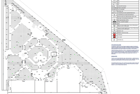
AS-BUILT FLOOR PLANS

Clear floor plans based on accurate site scanning, showing the existing layout, walls, openings, room relationships, ceiling heights, and important building features. A strong starting point for renovations, interior design, planning, and permit work.
REFLECTED CEILING PLANS
Existing ceiling plans showing lights, diffusers, bulkheads, ceiling height changes, exposed ductwork, and visible services for design and construction coordination.

PERMIT-READY DRAWINGS

Complete drawing packages for new buildings and custom renovations, including 3D drawings and permit-ready plans prepared from concept design to permit submission.
3D / REVIT-READY DRAWINGS

Scan-based 3D and BIM files prepared from point cloud data. Depending on the project scope, Revit models can be developed to various levels of detail, from general layouts to detailed building elements.
3D SCAN DATA / POINT CLOUD

Colorized, high-density point cloud data for measurement, review, and coordination. Files can be delivered in various formats, including LGS, PTS, E57, RCP, and others depending on project requirements.
CAD DRAWING PACKAGES
Professional 2D CAD deliverables prepared from scanned building or landscape conditions and provided in usable formats such as DWG and PDF. A reliable starting point for architects, designers, and contractors.
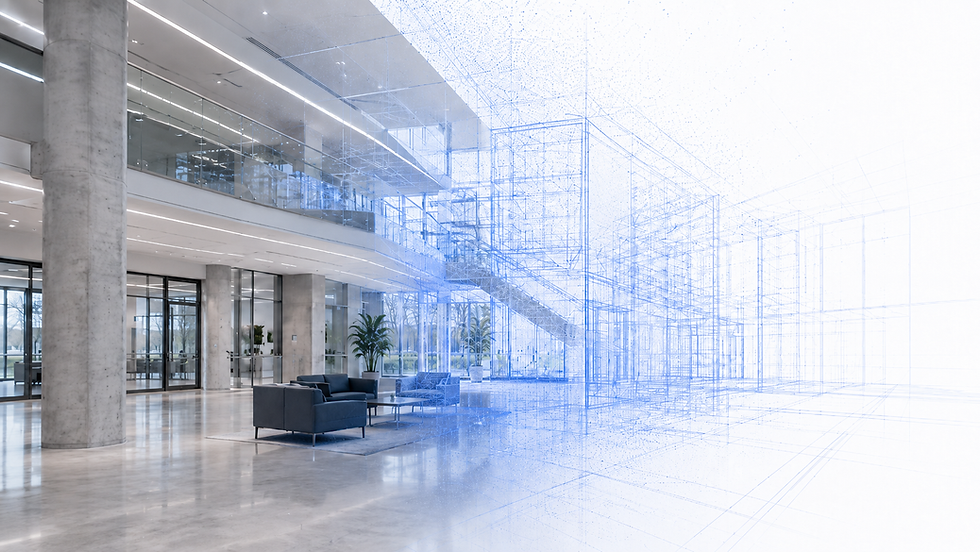
Architecture in Motion

This video shows how existing site conditions can be captured and translated into useful digital documentation. From point cloud data to scan-based BIM and Revit-ready support, the process gives architects and designers a more reliable starting point before renovation, redesign, or construction begins.
Architectural projects often begin with one critical step: understanding what is already there. By using 3D scan data as the starting point, we create accurate CAD documentation that supports design, renovation, permitting, and construction planning.